The Berkeley County Map Wall is a large format touchscreen kiosk built for the Berkeley County Museum. It lets visitors explore the American Revolution through an interactive map of historical sites, people, and stories. The app blends geospatial visualization, multimedia content, and a headless Drupal CMS to create a high quality museum experience. I contributed to this project as part of a collaborative engineering team.
The Berkeley County Museum preserves and interprets the history of Berkeley County, South Carolina, with a particular focus on Revolutionary War stories, early settlements, and cultural landscapes. As part of a broader exhibit renovation, the museum wanted an interactive digital feature that would help visitors explore these stories geographically rather than through static panels.
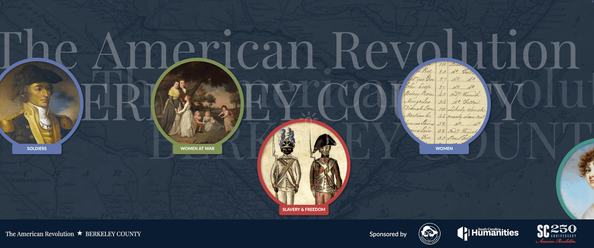
The Map Wall kiosk was created to give guests an intuitive way to discover people, places, and events directly on a large touchscreen map. The experience blends historical content, multimedia elements, and spatial storytelling into a single interactive display suited for all ages.
Give visitors a map-driven way to understand Berkeley County’s Revolutionary War history by exploring where major sites, people, and stories intersect.
Design a user interface that works naturally on a large touchscreen, with large tap targets, smooth map interactions, and simple navigation pathways.
Ensure all content, media, and map data work without internet access by creating a reliable sync pipeline that pulls data from the museum’s Drupal CMS.
Allow visitors to open detail panels that include images, text, audio narration, and, when available, video clips to deepen historical engagement.
Include an attract screen, idle timer, and auto-reset flow so the kiosk always returns to its starting state after periods of inactivity.
Challenge: Map rendering needed to feel smooth and stable, even on kiosk hardware.
Solution: Implemented MapLibre GL with optimized GeoJSON layers, throttled event listeners, and simplified marker geometry for consistent frame rates.
Challenge: The kiosk cannot rely on WiFi or network stability.
Solution: Built a Node-based sync script that downloads all text, images, audio, and video from the headless Drupal backend and stores them locally for instant offline use.
Challenge: Visitors needed to browse People, Places, and Stories without feeling overwhelmed.
Solution: Designed category filters, color-coded markers, and consistent card layouts to keep exploration simple and predictable.
Challenge: Exhibits can be left mid-interaction.
Solution: Added idle timeout logic that returns the kiosk to the attract screen after a few minutes of inactivity and clears any open detail views.
Challenge: Exhibits must be readable and intuitive for a wide range of users.
Solution: Applied touch-first UI patterns, large buttons, high-contrast visuals, and minimal multi-step actions.
Validated the kiosk on museum hardware to ensure map performance, audio playback, and touch reliability worked under exhibit conditions.
Tested multiple full sync cycles to guarantee that the kiosk stayed up to date with the museum’s Drupal CMS content and remained functional offline.
Confirmed that panning, zooming, marker selection, and scrolling felt natural across different ages and hand sizes.
Monitored reset timing and loop behavior to ensure the kiosk returned to a clean state consistently.
Visitors reported enjoying the ability to explore the county’s Revolutionary War history spatially rather than through static signage.
Guests could independently browse content without requiring staff guidance, reducing bottlenecks during busy days.
The combination of map visualization, story panels, and multimedia content helped connect historical narratives with real geographic locations.
The kiosk performed consistently through long museum operating hours without needing manual resets or network connections.
The map interface gives guests a dynamic, self-guided path into Berkeley County’s historical landscape.
Automatic syncing and offline stability mean the museum can update content without technical overhead.
The app’s architecture supports adding more stories, media, or new geographic layers over time.
Interested in working together? I'm always open to discussing new projects and opportunities.
An interactive AI voice kiosk designed for the EarlyWorks Children’s Museum to welcome families, guide visitors through exhibits, support accessibility needs, and provide a playful, museum-themed digital ambassador. Gear-y blends curiosity, safety-focused communication, and a kid-friendly personality to create a warm, educational first point of contact for guests.
A 12-foot interactive alien oracle, combining a large inflatable sculpture with a reflective, poetic AI voice kiosk experience designed for the LEAF Global Arts & Music Festival. Athena guides visitors through gentle conversation, encouraging mindfulness, curiosity, and wonder while maintaining safe, inclusive dialogue.
A playful, educational mascot project developed for the City of Cedar Park to promote community-wide water conservation. The initiative included designing a warm, engaging character personality, creating conversation-safe AI interactions, and deploying a public-facing interactive kiosk that helps residents learn water-saving habits through humor, clarity, and accessible guidance.
Have an AI project in mind or need a secure, reliable system built? Let's talk.